
Reviewed · PUERTO RICO
Puerto Rico Unlocked 500+ Hidden Gems and Spots
Puerto Rico Unlocked turns the whole island into a flexible road-trip plan, with more than 500 locations marked on a phone-friendly Google Map. You can choose a quiet beach, a river pool, an old church, a mountain viewpoint, or a roadside food stop without being tied to a guide or a fixed schedule. I like the direct Google Maps links and the sheer range of choices. I also like that the map reaches beyond San Juan and the usual El Yunque outing.
The catch is simple: this is a planning tool, not a guided tour. You need a rental car, your own judgment, and enough time to check road conditions, opening hours, weather, parking, and entrance fees. Rivers deserve special caution, since rain can turn a calm swimming spot into a dangerous place quickly.
Key Points at a Glance
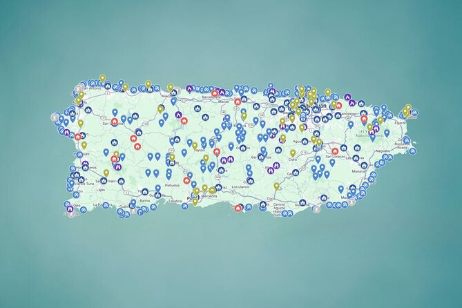
- 500-plus locations across Puerto Rico: Find beaches, rivers, waterfalls, caves, viewpoints, churches, plazas, food stops, and historic places in one map.
- One-tap navigation: Click a pin and open Google Maps, which saves time compared with copying addresses from scattered websites.
- Eight themed exploration days: The plan covers rivers, beaches, viewpoints, history, food, unusual places, plazas, and sacred sites.
- Self-guided freedom: You set the pace, skip anything that does not suit you, and build a route around your own base.
- Lifetime digital access: You can keep the map and receive new locations and updates over time.
- Best for independent drivers: The map does not include a car, fuel, parking, meals, equipment, or a guide.
What You Are Really Buying for $29.99
At $29.99 per group of up to 15 people, the value comes from saved planning time rather than transportation or admission. You are paying for a ready-to-use collection of places, organized into categories, with directions, photos, tips, and links attached to the pins.
That price can look especially good for a group sharing one rental car. Split among several people, it costs less than many single guided activities. You also keep access after the trip, which is useful if you return to Puerto Rico or want to build a second route later.
The map does not make the island cheap by itself. You still pay for the car, fuel, tolls, parking, food, and any entry charges. Some river or cave outings may also require equipment such as life jackets or helmets, and those are not supplied.
I would compare the cost with the value of your time. If you enjoy searching through dozens of web pages and sorting out which information is current, you may not need this. If you would rather spend one short planning session building a sensible route, the purchase earns its keep quickly.
Other Puerto Rico days people book alongside this one:
- San Juan Guided Snorkel With Turtles Tour and Videos
★ 5.0 · 12,947 reviews - Top Rated El Yunque Rainforest & Waterslide – SmallGroup Tour
★ 5.0 · 12,789 reviews - Half-Day Yunque Rainforest Waterslide & rope swing Guided Tour
★ 5.0 · 6,534 reviews
How the Eight-Day Plan Works
The itinerary is organized as eight suggested days, with about four hours assigned to each theme. These are not escorted four-hour tours. They are broad planning sections that help you decide what type of place to visit each day.
You do not need to follow the order. The starting point is listed as Plaza Colón in Old San Juan, but the map itself can be used from anywhere. If you are staying in Ponce, Aguadilla, Luquillo, or another part of the island, choose nearby pins and ignore the sample sequence.
The main advantage of this arrangement is choice. A fixed sightseeing tour gives you one route. This map gives you a menu, which is far better for a long stay or a group with mixed interests. The tradeoff is that you must make the decisions yourself.
Day One: Rivers Around Río Grande
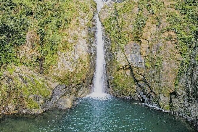
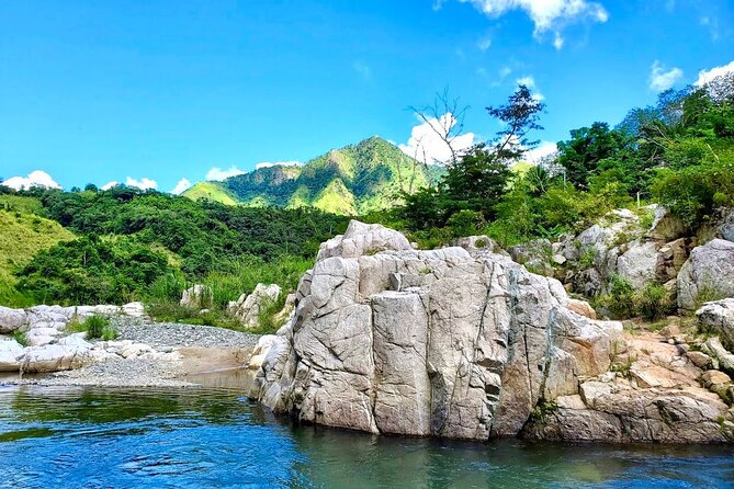
The first section gathers 87 rivers, including waterfalls, natural pools, and quieter swimming areas. Río Grande is a logical starting point because it places you near the rainforest region and many water-based outings.
This category suits people who want more than a quick photograph. You might spend part of a day beside a calm pool, look for a waterfall, or choose a spot that feels less built up than a public beach. The map’s photos and notes can help you judge whether a place matches your plans before you drive.
Use extra care here. The safety note is not a small footnote: you should check the forecast before visiting any river and avoid going when rain is possible. Water levels can rise fast, and strong currents may appear even when the river looks calm at the trailhead. Cloudy conditions are also given as a reason to postpone a river visit.
I would treat this section as a list of possibilities, not a promise that every location is suitable for casual swimming. Your physical fitness matters, and the map does not provide equipment. A rental car gets you close to a location, but it does not remove the need for caution.
Day Two: 105 Beaches Around Aguadilla
The beach section includes 105 shores, from quiet spots to family-friendly stretches with palms and nearby food stalls. Aguadilla is the listed focus, but the collection is intended to cover beaches around Puerto Rico rather than one single waterfront.
This is one of the most useful categories for a road trip. You can choose a beach based on your mood, location, or time available instead of defaulting to the most famous shore. A family may want an easy stop with food nearby, while a couple or solo visitor may prefer a quieter place for a few hours.
The sheer number of pins is both the strength and the challenge. One hundred and five options can save you from repeating the same beach, but you will need to compare distances and decide how many stops are realistic in one day. Do not treat the list as a checklist. Puerto Rico is larger than it can look on a map, and driving between several corners can consume the day.
Parking, access, and conditions can vary. The price does not include parking or transportation, so keep a little flexibility in your budget and schedule. The map helps you find options, but it cannot guarantee that every shore will suit your car, mobility level, or weather conditions on the day you go.
Same island, a completely different kind of day:
- El Yunque Rainforest Waterslides and Luquillo Beach w/ Transport
★ 4.5 · 5,098 reviews - Night Kayak – Condado City Lights Tour
★ 4.5 · 4,807 reviews - Luquillo Beach Horse Ride from Carabalí Rainforest Adventure Park
★ 5.0 · 4,762 reviews - Authentic Flavors of San Juan Food Tour
★ 5.0 · 4,741 reviews
Day Three: Viewpoints Near Lares
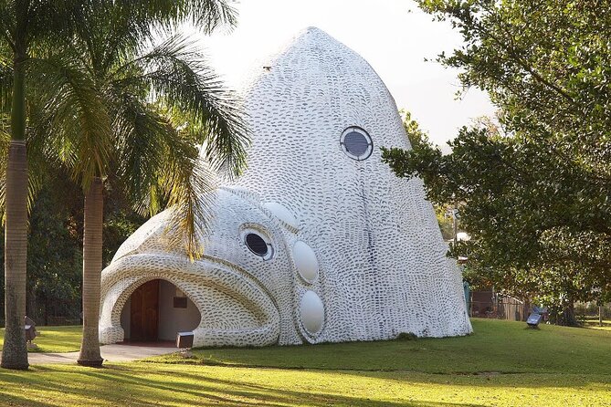
The viewpoint section includes 21 scenic stops, with mountain views and wide looks toward the Caribbean. The Lares focus gives this day a more rural, high-country feel than a standard coastal outing.
I like this category because it slows the trip down. Not every good Puerto Rico stop involves swimming or hiking. A viewpoint can give you a break from the car, a chance to take photographs, and a sense of how the island changes from coast to mountain.
The notes describe locations ranging from high mountain positions to sea-facing overlooks. That variety makes the map useful for planning a route with changing scenery. You can also pair a viewpoint with another category, such as a plaza, church, or food stop, rather than treating it as a complete day on its own.
The practical issue is time. A viewpoint may look close on Google Maps but still require winding roads or a detour. Build in room for slow driving and do not assume that four hours means four short stops. If you are uncomfortable with mountain roads, choose a smaller number of viewpoints and check the route carefully before leaving.
Day Four: Historic Places Around Aguada
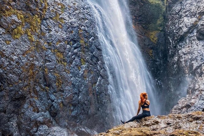
This section brings together forts, churches, tunnels, and colonial buildings. It is a good counterweight to the natural attractions and gives you a way to understand Puerto Rico through buildings and town streets rather than only through scenery.
The collection includes places connected with battles, faith, and the island’s past. You may find that a church or old structure takes only a short time to visit, but the surrounding town can make the stop more meaningful. Allow time to walk, look up at details, and notice the setting instead of rushing from pin to pin.
Aguada is the listed center for this day, though the wider map lets you locate historic places elsewhere. I would use the category to build a route around towns rather than trying to cover every site. Some buildings may have limited hours or restricted access, and admission is not included where fees apply.
This is also a useful option when the weather is not right for rivers or beaches. The map gives you a way to change plans without abandoning the day entirely.
Day Five: Food Stops Around Luquillo
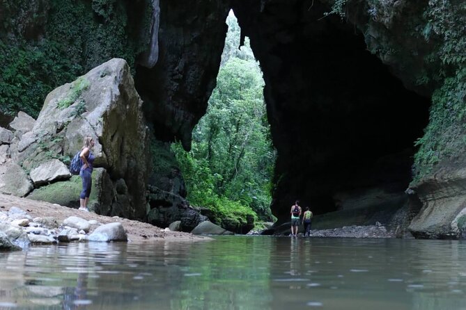
The food section highlights nine places for Puerto Rican flavors, including alcapurrias, mofongo, lechón, and tropical drinks. Luquillo is the focus, and this is one of the easiest categories to fit into another day.
Food stops give your road trip a sense of place. A meal or snack can be as memorable as a viewpoint, especially when you use it to break up a long drive. The selection points you toward familiar Puerto Rican dishes rather than generic restaurant choices.
Nine locations is a manageable number, but do not read that as an instruction to eat at all nine. Pick one or two that fit your route and appetite. Food, drinks, and personal spending are not included in the purchase, so plan to pay directly at each stop.
I also like the practical way this category can connect with the others. You might visit a nearby beach, plaza, or historic site, then use a food pin for lunch. That is a better use of the map than crossing the island simply to chase one dish.
Day Six: Unusual Places Around Ponce
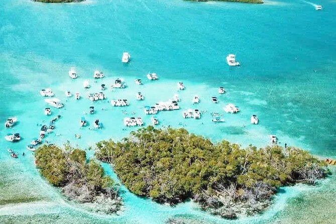
The Ponce section gathers more than 50 places that do not fit neatly into the main categories. It includes tunnels, unusual rock formations, waterfalls, large sculptures, stairways, and other odd corners of the island.
This may be the most fun section for people who have already seen the standard sights. It is built for curiosity, and it gives you permission to stop for something simply because it is strange, unexpected, or visually interesting.
The category is also the least predictable. A tunnel or rough outdoor site may require more preparation than a plaza or museum. The map may point you toward a place, but you still need to check what the visit involves, what footwear makes sense, and whether access is currently practical.
Ponce gives this day a strong southern anchor, but you should not try to force every unusual place into one outing. Pick a few locations that work together geographically. The map is most useful when you use it to make a sensible route, not when you attempt to collect pins.
Day Seven: Town Plazas Around Toa Alta
The plaza section includes more than 50 town squares. These are places for everyday island life: music, children playing, pigeons, shade trees, and people gathering in the center of town.
Plazas are easy to overlook because they are not usually marketed as major attractions. That is exactly why they can add something genuine to your trip. You get to see how towns are arranged and where local life takes place, rather than moving only between beaches and scenic overlooks.
This category works well for a flexible afternoon. Stop at one plaza, walk around, find a nearby church or food place, and continue only if the next location fits. You do not need special equipment or a high fitness level for most plaza visits, though the supplied information does not guarantee identical conditions at every site.
The main drawback is that plazas are not all the same kind of attraction. If you want a packed sightseeing schedule, some may feel too quiet. If you enjoy observing a place at an unhurried pace, they can be among the most rewarding stops on the map.
Day Eight: Churches and Sacred Sites Around Carolina
The final section includes more than 87 sacred sites, from major cathedrals to small hilltop chapels. You do not need to be religious to appreciate the architecture, setting, and role these buildings play in Puerto Rican towns.
This is another category that rewards slower travel. A church may be a short stop, but it can connect with a plaza, historic building, or local food stop nearby. The variety between grand structures and modest chapels also gives you a broader view of the island than a single famous church would.
Carolina is the listed focus, but the collection reaches across Puerto Rico. As with historic locations, opening hours and access may differ. Respect local customs, check whether a service is taking place, and do not assume every site is open for casual sightseeing.
The sacred-sites section is especially useful for rainy periods when outdoor swimming is not wise. It gives you a culturally focused option without requiring a long hike or a full-day excursion.
Using the Map Without Wasting Your Vacation
The map is easiest to use when you plan by region instead of by category. Start by marking a few places near where you are staying, then add one or two nearby stops from another category. This prevents the common road-trip mistake of zigzagging across the island for isolated pins.
Use the built-in photos, tips, and links before you leave. Look for clues about parking, walking, weather, access, and whether a location is best for a short stop or a longer outing. Then open the pin in Google Maps and check the actual driving route.
I would save a small daily list rather than trying to visit everything. Three well-matched locations can make a satisfying day. Ten distant pins can turn into a day spent mostly behind the wheel.
The map is mobile friendly, but your phone still needs power and a usable connection. The supplied information confirms phone access and Google Maps navigation, but it does not promise offline navigation, transportation, or a guide. Downloading or preparing directions in advance would be sensible, especially for rural areas.
Who Will Get the Most From It
This purchase fits you best if you:
- Have a rental car and enjoy choosing your own route.
- Want quiet beaches, rivers, viewpoints, historic places, and local food options.
- Are staying in Puerto Rico for more than a few days.
- Prefer flexible plans to a guided group schedule.
- Are traveling with friends or family and want one shared planning tool.
- Like using your phone to compare options as you go.
It is less suitable if you want a driver, a guide, arranged admissions, or a fixed sightseeing program. It also may not suit you if you dislike researching conditions before outdoor activities.
The listed maximum is 30 people, while the price covers a group of up to 15. Since this is a digital map rather than a conventional group excursion, confirm the group arrangement when booking if your party is larger than 15.
Practical Limits, Safety, and Cancellation
The map does not include transportation, fuel, tolls, parking, meals, drinks, admission, or rental equipment. Most places are free, but you should keep money aside for exceptions.
A moderate level of physical fitness is recommended. That matters most for river, waterfall, cave, and unusual outdoor locations. Check the forecast before every river visit, and avoid rivers on cloudy days or when rain is possible anywhere upstream.
The purchase is non-refundable and cannot be changed for any reason. Since you cannot cancel for a refund, check your dates, rental-car plans, and general interest in self-guided driving before paying.
Should You Buy Puerto Rico Unlocked?
I would buy it if you want to explore beyond the standard San Juan, El Yunque, and beach circuit and you already plan to rent a car. The strongest benefits are the direct navigation, the broad range of categories, and the time saved when building a route.
I would skip it if you are staying in one small area, prefer escorted activities, or will not have a car. The map gives you choices, not supervision. You still need to judge weather, access, distance, and safety.
For a group sharing the $29.99 cost, the value is strong. You get a large island-wide reference tool, lifetime access, and regular additions, but the best results come from using it as a smart planning aid rather than a checklist.
FAQ
What is Puerto Rico Unlocked?
It is a self-guided digital Google Map with more than 500 locations across Puerto Rico, including beaches, rivers, waterfalls, caves, viewpoints, historic sites, plazas, churches, food stops, and unusual places.
Is this a guided tour?
No. It is a self-guided map. There is no guide, fixed schedule, included transportation, or arranged group sightseeing.
How do I navigate to each location?
Use the mobile map, tap a location pin, and open the place directly in Google Maps for navigation.
How long does the experience last?
The suggested plan is organized over approximately eight days, with about four hours assigned to each day. You can use the map for a shorter trip or spread it over a longer stay.
Do I need a rental car?
Yes. Transportation is not included, and the experience is designed for self-driving. Fuel, tolls, and parking are also your responsibility.
Are entrance fees included?
No. Most locations are free, but some places or parking areas may charge an admission or access fee.
Does the map include food and equipment?
Food and drinks are not included. Equipment such as helmets or life jackets for cave and river visits is also not provided.
Is the map available after the trip?
Yes. The purchase includes instant and lifetime access, with new locations and updates added regularly.
What should I know before visiting a river?
Check the weather carefully and only go when conditions are completely sunny with no rain expected. Rivers can rise quickly and develop strong currents after rain, so avoid river visits on cloudy days or when rain is forecast.
Just added around Puerto Rico
- CLEAR BOTTOM KAYAKS Tour in Bioluminescent, Mosquito Bay★ 4.0 · 30 reviews
- Private Tour of the White Canyon Ancestral Route in Utuado★ 5.0 · 7 reviews
- eFoil Lesson Old San Juan★ 5.0 · 5 reviews
- “Unique Tour” Loiza, Cultue, Art & Bomba Dance Class on The Beach★ 5.0 · 22 reviews
- Private Windsurf Experience in Puerto Rico★ 5.0 · 7 reviews
- Window Cave and Indian Cave private tour with an archaeologist as guide★ 4.5 · 9 reviews
- Private Wellness Tour of Puerto Rico Waterfalls and Hot Springs★ 5.0 · 5 reviews
- PR Chinchorreo-Beach and Bar Hopping Tour★ 4.0 · 28 reviews